Maps
The maps in this section include many of the places mentioned in the Joseph Smith Papers and can help readers visualize the locations that were significant places in Joseph Smith’s life and the early years of the Latter-day Saint movement.
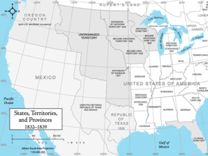
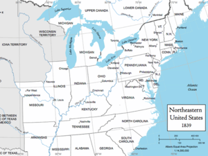
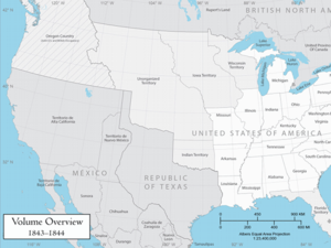
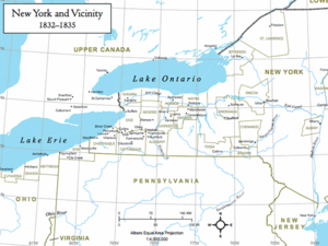
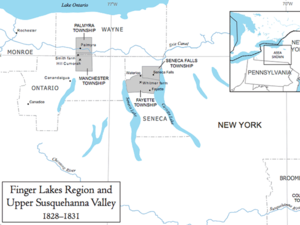
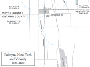
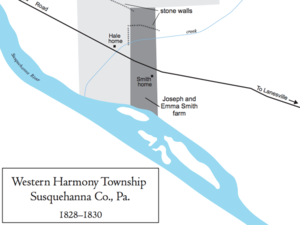
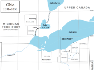
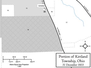
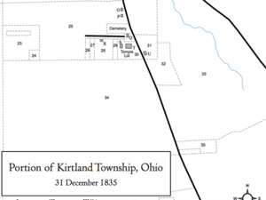
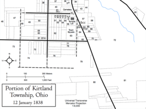
The first section includes the travel and missions of JS; the other sections correspond to the various areas where Joseph Smith lived: Western New York and Northern Pennsylvania, Ohio, Missouri, and Illinois and Iowa Territory, as well as maps of the United States in the 1830s and 1840s. Geographical names, borders, and watercourses appear as they existed in the time period given in the map titles. For more information about geographical locations, see the Places page.
Travel and Missions
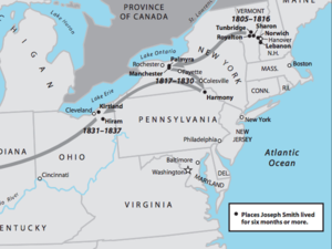
Joseph Smith’s Residences
Joseph Smith’s major places of residence and the general direction of his migrations.
Mission to the Indians, 1830–1831
Oliver Cowdery, Peter Whitmer Jr., Ziba Peterson, and Parley P. Pratt departed New York in October 1830 on a mission to preach to the “Lamanites” in Indian territory. Frederick G. Williams joined the group in Ohio. They preached to the Indians in early 1831, but they were soon ordered off Indian land.
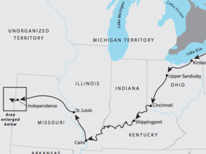
Joseph Smith’s Travel between Ohio and Missouri, 1831
In accordance with instructions in a June 1831 revelation, Joseph Smith and several others traveled from Kirtland, Ohio, to Jackson County, Missouri, where a new revelation designated Independence as the “centre place” of the city of Zion.
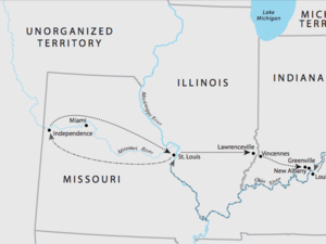
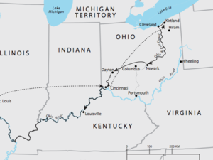
Joseph Smith’s Travel between Ohio and Missouri, 1832
In accordance with instructions in a March 1832 revelation, Joseph Smith, Sidney Rigdon, and Newel K. Whitney traveled from Hiram, Ohio, to Independence, Missouri, to counsel with church leaders.
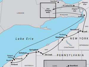
Joseph Smith’s Proselytizing Mission, October–November 1833
In the fall of 1833, Joseph Smith and Sidney Rigdon traveled with church member Freeman Nickerson from Kirtland, Ohio, to Mount Pleasant, Upper Canada.
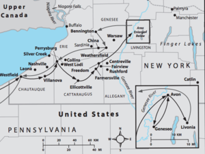
Joseph Smith’s Recruiting Mission, February–March 1834
In early 1834, Joseph Smith and Parley P. Pratt traveled from Kirtland, Ohio, to western New York to enlist recruits and raise funds for an expedition to help exiled Latter-day Saints reoccupy their lands in Jackson County, Missouri.
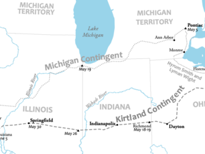
Camp of Israel Route, May–June 1834
In May and June 1834, the Camp of Israel traveled to Missouri to assist the Saints who had been driven from Jackson County, Missouri.